Where are we now?

Saturday, May 26, 2018

Hope Town 2

07 May 2018

We had lunch at the club on the Atlantic side of the island. This was the view from our table.


And the beach below.


After a nice lunch we trundled back down the street (barely wide enough for two golf carts to pass each other). We got another picture from the vacant lot, this time with the boat centered (it's all the way in the back).


That lighthouse light panned across our boat in the sound all night. It felt a little like one of those jailbreak movies. The last winding must be at about 3a because after 5a, just before sunrise, it was stationary.


It was quiet - too quiet.

sv-hiatus.blogspot.com

Friday, May 25, 2018

Hope Town 1

06 May 2018

We were getting antsy again in Marsh Harbor, so off we went to Hope Town. It was only a couple hours away, and the weather was okay, with us dodging a few small squalls. We picked up a mooring near the entrance. We asked a neighboring boat how to pay, and they said a guy would be by in a skiff.

Hope town is on Elbow Cay, identified by their lighthouse. It is still powered by kerosene, and wound by hand every two hours.


This place is just impossibly picturesque. We took the dinghy to the public dock and tied up. It was Sunday, so it was pretty quiet. We talked to some folks that had a house on the island, and they recommended one of the few places open on Sunday, the club up the path. On the way there there was a little park on the Atlantic ocean side.


On the way back there was another wooded lot between houses, which anywhere else would jut be a vacant lot. You could just see the light house across the sound.


sv-hiatus.blogspot.com

Monday, May 14, 2018

Marsh Harbor (1)

30 April to 05 May 2018

We arrived at Marsh Harbor, the big city of the Abacos with a population of about 6000 souls. We originally intended to stay for four days to get the lower rate, but the weather was iffy on and off and the town was nice so we ended up staying a little longer. MH had not just one supermarket but two, along with various bodegas, and a high ratio of liquor store square footage given the population.

On Tuesday we rented a car and drove up to Treasure Cay, which is not really a cay, which is why we could drive to it. They drive on the left, so I was having Scotland flashbacks. We scoped out the marina and mooring area. It seemed like a quiet place to hang out for a few days. It's known mostly for the beaches. 

While we had the car we also did a grocery run. We returned the car before dark so we didn't have to figure out where to park it. By the third or fourth day we had walked most areas and tried most of the restaurants. The only chain fast food place in town, I think in all of the Abacos, is a KFC.


We checked out the large harbor on how we would anchor if we wanted to. We drove to the other side of the harbor to see Mermaid Reef, where we might be able to do some snorkeling.

We finally found a BTC office that was both open and had SIM cards, so I bought one for the iPad. I started to get the hang of the SIM card shuffle, but it looked like BTC blocked hotspot usage.

It was nice to have most of the perks of civilization within a walk away, but we started getting antsy again and we decided to head out again, this time to Hope Town.

The shot below was taken at dusk while most of the anchored boats still had their mast lights on.


sv-hiatus.blogspot.com

Sunday, May 13, 2018

Great Guana Cay

29 April 2018

When we left GTC we went south, briefly heading into the Atlantic via the Whale Cay passage. While the passage is usually calm, it can be subject to what is called a rage, where waves are breaking. This is bad, as breaking waves sink boats. So every morning on the VHF radio people share their observations in or at least near the passage to see if it is navigable.

Our next stop after the passage was Great Guana Cay, home of the world famous bar called Nippers (world famous at least to boating people). You see Nippers t-shirts everywhere boaters are.


It looks out over the Atlantic at a beautiful beach and reef.


We were at least twice the appropriate age for Nippers. After a few drinks, some conch, and a run through the pig roast buffet we rolled back to the other side of the island where our boat was moored.

Facing our boat was another bar called Grabbers. Our boat is in the middle there somewhere.


Later that evening the moon was rising over the bar, so the shot below is from our boat looking back at Grabbers.


The sunset was beautiful.


These were our good experiences in Fishers Bay at Great Guana Cay (foreshadowing).

sv-hiatus.blogspot.com

Saturday, May 12, 2018

Exploring GTC

26 - 28 April 2018

In the morning we started exploring GTC. It soon became clear that some assistance would be nice, and we tried to rent a golf cart. After the second place had rejected us for no reservations (?!) the first place had an early return we could snag. We had wheels. We put putted about the island for most of the afternoon. The island is only three miles long, so it really doesn't take forever. The original settlement area is quaint and very compact, with streets well sized for golf carts. Two hundred years ago, how did they know?


There was a little memorial park in the town center. It seems like a dozen last names account for much of the population.


Back at the resort, the bar is apparently know for displaying burgees from visiting boaters, and dollar bills personalized in various ways. They're running out of room.


The next day we picked up some squid bait (bait squid?) and headed for Coco Bay, where there were supposed to be green turtles you could feed. The fish snagged some, with an especially aggressive little barracuda, but Heather was finally able to feed a turtle.


Later that evening we went to rib night in town. Instead of going back like we should have, we went to a bar called Pineapples. Soon after we got there it started to pour. Then it really started raining. By the time we got back to the golf cart we were already soaked. There really isn't anywhere to go from there. Sunrises and sunsets in the lagoon were great.


sv-hiatus.blogspot.com

Wednesday, May 9, 2018

Green Turtle Cay

25 April 2018

We were really dragging in the morning because we had not slept well at Spanish Cay. We were one of the last boats out of the marina. We declined a trip to the fuel dock after seeing the difficulty another sailboat was having approaching in the 20 knot winds. Out we went, giving the shallows south of the island a wide berth, then on the Green Turtle Cay, only a few miles away.


The entrance to White (north) sound was tricky, tough to see. The channel is very shallow so we were approaching at high tide. The channel wasn't even wide enough for the powerboat behind us to feel comfortable overtaking us.

Once inside the fairly small sound there was some confusion about mooring balls. We found one with local dive shop's name on it, like we were looking for, but couldn't see number on it anywhere. We tied up to it anyway. When we got to the office they admitted they needed to be repainted, although "everyone" knew which was which. The charter boat which had reserved the last remaining ball picked up the other mooring, one we didn't even see until it was pointed out by the dive shop proprietor (the charismatic Brendal), so it all worked out.

We arrived without having arranged transportation, apparently a rookie mistake, so we stayed near the resort. We were hungry because it was a travel day and we don't eat much before we arrive. Since it was between lunch and dinner, the only thing open was the pool bar. Off we went.


Turns out they didn't have food either because their cook  station was down. But they did have lots of fabulous drinks on special, some of which might as well have been boozy milkshakes, so close enough for a snack.

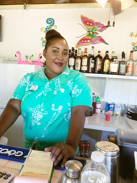
The bartender, named Ashley, said her grandmother invented the Goombay Smash, and that if we wanted an authentic one we should go to the family's Blue Bee bar in town. At that point we were already smashed enough to believe anything.


We had a dinner that night in their dining room that was a little too nice for our informal attire. We were too tired to care much, and it was very good.

sv-hiatus.blogspot.com

Monday, May 7, 2018

Spanish Cay

24 April 2018

The next morning looked at least as good, and the weather forecast showed increased clearing between the squalls, so on we went. Our next stop was Spanish Cay, the first civilization we would hit since West End five days before. It's a private island with a little resort and even a small airstrip.

On the way there we were lucky to only hit the edge of a very large squall. A boat behind us said on the VHF it went on for at least five miles. The trail of storms continued all the way towards Florida.


We got there pretty early and the marina was empty, but by dark it was almost full. That should have set off some alarm bells. In retrospect I was a little too casual setting up the dock lines. When I asked to get wifi they cautioned me that it was satellite and didn't work well with the bad weather, so I declined. We had a nice little dinner at the marina restaurant.


Late that night all hell broke loose. The breakwater wasn't solid and waves were just plowing right over it, slamming into our fairly flat stern. Then some really impressive winds hit, stretching one of our spring lines at least a couple feet so our anchor was actually hitting the dock, which in turn was kicking up the cover for the anchor well with a bang that sounded like a gunshot. It took us a few minutes to figure this all out in the wind and the rain and the dark. It took all my (substantial) weight to pull the spring line in a couple feet and get us off the dock.

Even with us not hitting the dock the waves kept slapping our stern all night. In the morning we noticed that all of the powerboats, and most of the sailboats, had docked stern in, so their bow was facing more toward the entrance and the breakwater.

At some point during  the night the power on the boat went out, but I no longer really cared. In the morning we found out it wasn't just us. One of the island generators had blown during the storm. In the morning I also saw that our anchor had chewed about six inches off the end of one of the dock planks. Oops. The anchor and the rest of the boat looked fine once I brushed the chunks of wood off.

Next time we had wifi I noticed that a late weather supplement email had come in earlier that evening at Spanish Cay, a few hours before the storm had hit, because conditions had worsened, potentially forming some pretty explosive storm cells with winds of up to 70 knots. That would have been good to know. I don't think we got hit with the full extent of that, but it was similar or even a little worse than the 50 knot storm we had seen at the dock in New Orleans last year. We need to keep working on our weather source(s) when away from the states.

sv-hiatus.blogspot.com

Sunday, May 6, 2018

Anchor Drill

23 April 2018

In the morning there was some blue sky with isolated squalls drifting though. We were tired of sitting so we decided to go. We were making decent time but it was a little bouncy. Not bad at all in the direction we were headed.


But then there was a big squall in our path that I didn't like the look of. When I had done this before with John K we had gotten all too close to a couple of waterspouts in a squall like that.


First I slowed down to try and let it pass in front of us. When that didn't buy us enough I started turning north, in retrospect a mistake. The motion of the boat became much less comfortable as the swells started hitting us abeam. Strangely I was fine but Heather was uncomfortable. Usually it's the other way around, but when the wind was behind us she got a blast of diesel exhaust which she really doesn't like.

The squall stalled for a while and I ended up circling all the way back the direction we had come from. By then we were ready to call it a day. If I had known I should have initially turned south, towards the nearest middle of nowhere cay that was a good stopping point, call Great Sale. We finally turned south and headed over to the southern tip on the west side. There was a large trawler tucked way up in the harbor, and a little sailboat to his east.


We anchored in a way that we thought was aggressively close, maybe 300 yards off the beach, but another sailboat came in late and dropped they anchor at maybe half our distance to the beach and the shallow area north of us. The wind was from the east, so it shouldn't have mattered, until it did.


Another strong squall came through late that night. All the sudden the anchor alarm was going off and I was about 10 seconds from having Heather run up top and start the engine. The squall was strong enough to counter the prevailing east wind and back it all the way around to the west. We were now being blown toward the beach, and I wasn't initially certain whether we were dragging closer or not.

It soon became clear that if we had dragged it was only maybe 20 yards before the anchor had reset (yay oversized Rocna). The squall passed on and the prevailing east wind slowly resumed, blowing us back away from the beach. Lesson learned - local squalls can be strong enough to temporarily overcome prevailing winds.

In the morning the sailboat north of us was now several hundred yards off the beach. It looked like things had gotten a little too close for them where they were and they had to reposition in the dark. Not fun.

sv-hiatus.blogspot.com

Saturday, May 5, 2018

Sitting Tight

21-22 April 2018

That night the weather we had been expecting hit. Everyone stayed put the next day. We watched DVDs and read and did little chores. Just feeding yourself on the boat then cleaning up takes quite a while, especially when the boat is moving some. The wind wasn't that bad and the island kept the worst of the swells away. They don't get that big on the banks to begin with.


The next morning the cat was gone but we were still not feeling good about leaving. Part of the issue was getting used to the limited connectivity for weather reports. I was getting what we had from our little sat texter, which was okay but not very detailed. We stayed put a third night, but we were getting a little antsy. On the other hand, we had two zero dollar days, where absolutely no money was spent by either of us. Those help bring the average down for our little adventure.

sv-hiatus.blogspot.com

Friday, May 4, 2018

Next Step in the Bahamas

20 April 2108

The West End marina wasn't cheap. They have a monopoly in a pretty good spot. We needed to get out of there while our credit cards still worked. The weather looked good for the day but something else was rolling in soon. After taking forever to fuel up at the dock we headed north from the marina about mid-day to the cut onto the banks. This is a pretty shallow cut and I wasn't thrilled, but I didn't want to go farther north to the somewhat deeper water either. At least it was near high tide.

We turned into the cut and just followed the standard track through to the (slightly) deeper water on the banks. It took about an hour, with Heather driving and me on the bow, doing I'm not sure what. I was watching for shallow spots, but everything was shallow. The sun was high which at least was good for spotting. I think I had Heather slow down once for a section that turned out to be just sand scrubbed of sea grass, so it looked shallower that it really was.

On the other hand, I was at the bow when the dolphins came over. The water was so clear you could see every detail, including one's torn up fin. They didn't stay long so I couldn't get a picture. Then there was the patch of giant black and orange starfish. Once we got through the cut and onto the banks the water was a whopping several feet below the keel. Once again we were grateful we had lucked into the shallow draft keel. We proceeded across the banks on a beautiful day. At the center of the picture below is a sailboat that is maybe four miles away. This was the 360 degree view from the boat. It's always so crowded this time of year.


Since we got a late start we didn't get far, maybe 20 miles, to a little island called Mangrove Cay. FYI - "Cay" is pronounced "Key" here. There's not a lot to Mangrove Cay. It's uninhabited, but it's a stopover that offers a little shelter from the wind and swell. Since the dominant wind was from the east we went fairly far south on the west side of the island and anchored. A large cat was to the south of us, seemingly not behind the island at all, and way out. A couple more sailboats came in as the day was ending. In the picture below we are 3-400 yards of the beach.


We cooked dinner on the back of the boat while watching the sunset, watched a DVD of something and called it a night.


sv-hiatus.blogspot.com

Thursday, May 3, 2018

On Our Way

19 Apr 2018

After more of a long nap than a night's sleep we were up in the dark, making final preparations for departure. We got all the instruments up and running, started the engine, released the mooring, and we were off about 4a. We hadn't done much close quarters maneuvering in the dark since we left the gulf, but we were pretty used to the neighborhood by now. Even though we had gone under the 17th St bridge (55 foot clearance closed) on our way up, I was still a bit puckered going back under it again, this time in the dark. We supposedly clear by a couple feet.

We slipped beneath the bridge without a whisper, turned left, and we were looking at the ocean. Well actually it was dark, so we didn't see much other than nav lights. The ocean still had a little swell going, but it was supposed to keep smoothing out as the day went on. The gulfstream was about about 18 miles offshore so we set our sights on West End directly.

We had this whole plan to go south to Miami, or even farther, then cross over to Bimini, mostly because that is what I'd done before with John K. Since we were no longer trying to coordinate with anyone else's schedule we decided to finally let that go. All the guide books said do the Abacos first in the Bahamas, so we decided to ditch everything else entirely. It mostly worked out.

West End is much easier to hit when leaving from Ft. Lauderdale. It's the west end (go figure) of the northernmost banks in the Bahamas, and it's maybe 30 miles north of FtL, which makes the 3 mph north gulfstream work for you instead of against. It wasn't much after 5a when it seemed like the sun was starting to come up. With no other lights around you get a lot of warning. The swell settled down to a very calm 1 to 2 foot, with the occasional 3 or even 4 footer rolling through. Pretty nice for fair weather boaters like us.

About dawn the water seemed to warm up a little, and the boat speed over ground starting ramping up with no change in heading or engine rpms. We were in the gulfstream. We altered our heading closer to due east to get across the stream without overshooting West End. It was about 30 miles wide here, so we had maybe six hours of free ride north courtesy of the gulfstream. Once we were mostly out of the stream effects we pointed directly at West End again for our final approach.

We saw land maybe six or eight miles out, just some scrubby trees sticking up from a low, flat island. But the water was amazing. You could see things on the bottom like there was maybe a foot of water rather than 15 or 20 below us. I read somewhere to think of the banks like a giant dinner plate, with the edge ramping up slightly - but broken in spots, so some of the edge was lower than surrounding sections. The center of plate is just 15 feet below the surface of the water, with the edges less that that. As a result, the three-foot tide flowing over this giant plate, then six hours later off again, flushes a tremendous amount of water through the banks, making the water some of the clearest in the world.

We had some difficult spotting the cut into the marina, but some sportfishers with their giant wakes pointed the way. Heather guided us right into our slip. With no drama at all, we were in the Bahamas on our own boat. We raised our yellow quarantine flag and prepared to clear in. I gathered up our paperwork and passports and headed over to the government offices. After very little hassle (no guns or pets helped) we were admitted into the Bahamas. We pulled down our quarantine flag and raised one for the Bahamas per protocol.

We got a ride from the marina to the BTC office to try and get new sim cards for our phones and iPad. While they were open (we discovered this was unusual) they had been out of product for weeks (not unusual at all). Our phones were going to be at the mercy of AT&T for a while here. We grabbed some fish and chips on the way back and called it a day. The pic below is of our boat in the West End marina, Bahamian flag flying low for some reason.


sv-hiatus.blogspot.com

Wednesday, May 2, 2018

Mail Delivery and Final Preparation for Bahamas

13 - 18 April 2018

After Heather got back I had a lot of mail to go through. When you only pick up the mail every month or two it seems to really build up. That and more chores, like finishing the third rail section on the boat.

On Sunday we went back to a slip, hooking up the electrical this time for air conditioning and to top up the battery bank. To do so on this new dock we needed yet another electrical adapter, but this one wasn't too outrageously expensive and came in handy again very soon. We made final passes to the grocery store and marine supply houses.

We checked in with the insurance company for the boat to confirm our coverage for the Bahamas and topped up our water tanks. We started checking the weather religiously again, sometime three and four times a day, trying to find the best window for the gulfstream crossing. We rinsed off the boat again, finally swapped out our diesel jugs we use for an emergency reserve, and printed out and started filling out our Bahamas entry forms.

We knew we were getting close when on Tuesday we took the car to a long term storage place south of the airport and payed thru May. Here's one last shot of one of Ft. Lauderdale's creepiest residents, in this case hedge surfing to surprise people walking to the beach.


On Wednesday we took showers ashore and made one last visit to the French bakery before we left the slip. After pumping out at the adjacent dock we chugged down past the bridge to the fuel dock and topped up our new reserve diesel jugs and the main tank, and grabbed a last couple bags of ice.

We went back up to the mooring field and picked up a ball. We started preparing like we used to when we would take the kids to southern California on vacation. Pack up the car until we we ready to go, then don't. Wake up in the middle of the night and get started, and we'd be well on our way before the sun came up. So that's what we did.

The picture below is from the mooring field looking at the small park at the base of the bridge on the west side.


sv-hiatus.blogspot.com